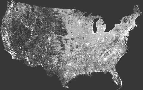
What happens if you produce a map of, say, the United States of America, only showing the streets? Will you be able to recognise non-man-made elements of the landscape, like mountains, or rivers? Well, it turns out yes, you can, as Ben Fry has done so. Interestingly, you can see how in the midwest there are counties that appear to have hardly any streets right in the middle of ones that are riddled with them - though this is apparently more due to how they identify a street than a lack of any thoroughfares. The difference between the east and the west of the continent is quite marked too - the west’s street patterns appear much more strongly influenced by the topography than the east, though given the scale and type of said topography, that’s hardly surprising. Here’s a scaled down image as a teaser, but definitely go and look at the originals.

